Centerline Mapping
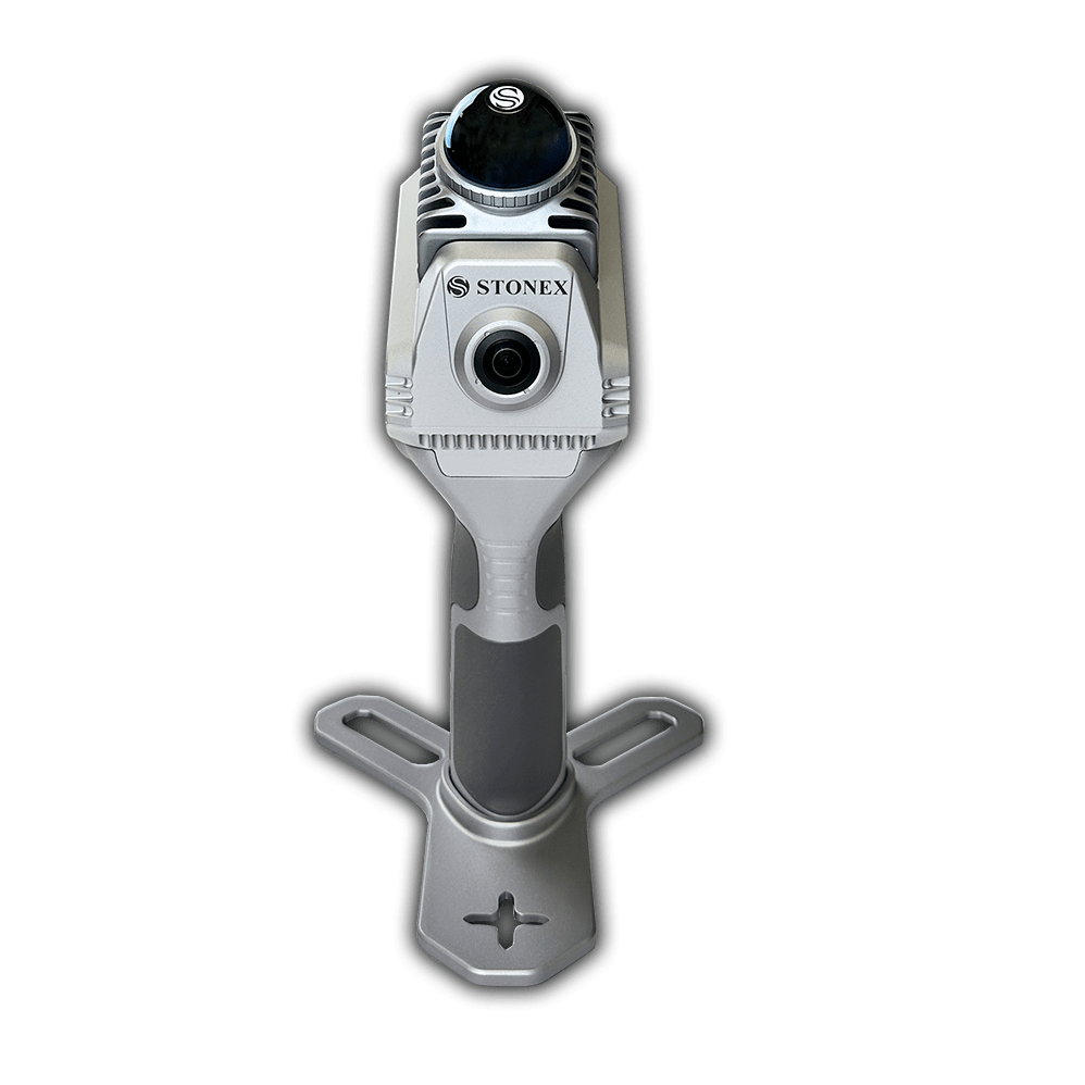
X40 Scanner
X40 Scanner
Couldn't load pickup availability
X40GO is a compact system providing high-precision point cloud data, based on SLAM technology.
The 70-meters range LiDAR orientation has been designed to maximize coverage and a 12-megapixel camera provides texture information to the 3D model.
The X40GO is a simple and affordable solution, ideal for interior building surveys and data collection, small-scale exterior site condition documentation, and 3D modeling applications.
Facilities Management | Structural Design | Utility Locating and Documentation | Damage Prevention | Inspections | Existing Conditions | Plant Operations | Architect | Engineer | Construction | Drones | Furniture Sales | Interior Design

GOapp
GOapp is Stonex SLAM’s dedicated mobile application to manage projects, real time point cloud display, image preview, firmware upgrade and other operations. The APP runs on Android and iOS operating systems.

GOpost
Windows post processing software which performs optimization processing, colouring of point clouds and creation of panoramic images. You can also import control points to georeference the point cloud.
Add-ons and accessories shown in photos sold separately.