Centerline Mapping
Cube 3D Office Software
Cube 3D Office Software
Couldn't load pickup availability
Cube 3D Office Software Photogrammetry, LiDAR, and 3D Data
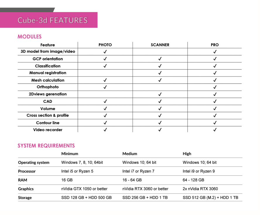
Cube-3d is a complete software for 3D data management, built by two modules for photogrammetry and for scanner data. The former processes images (or videos) to generate accurate digital maps and 3D models with extreme precision; the latter provides tools to align point clouds.
It is compatible with cube-a surveys and with any third-party 3D model. It is possible to draw on point clouds or meshes and merge data imported from traditional survey tools, all in a single software. The data can be then processed and enhanced thanks to the various CAD tools.
Among the many features available, most appreciated are the automatic classification, orthophoto, cross-sections and profile lines, volume calculation, and more. Licenses configuration is very flexible, from perpetual to temporary subscription, it adapts to the needs of many professionals.
Pricing is for either PHOTO or SCANNER module.
Reach out for pricing on both PHOTO & SCANNER & a 12 month license!